Loading…
نُعدّ التقارير والقرارات المساحية المعتمدة وتحديث الصكوك العقارية وفق متطلبات الأمانات والبلديات ومنصّة بلدي في السعودية. يشمل ذلك مطابقة الإحداثيات، ضبط حدود الصك على الطبيعة، وإعداد الكروكي والمساحة المعتمدة المطلوبة لإصدار رخص البناء والقرارات المساحية.
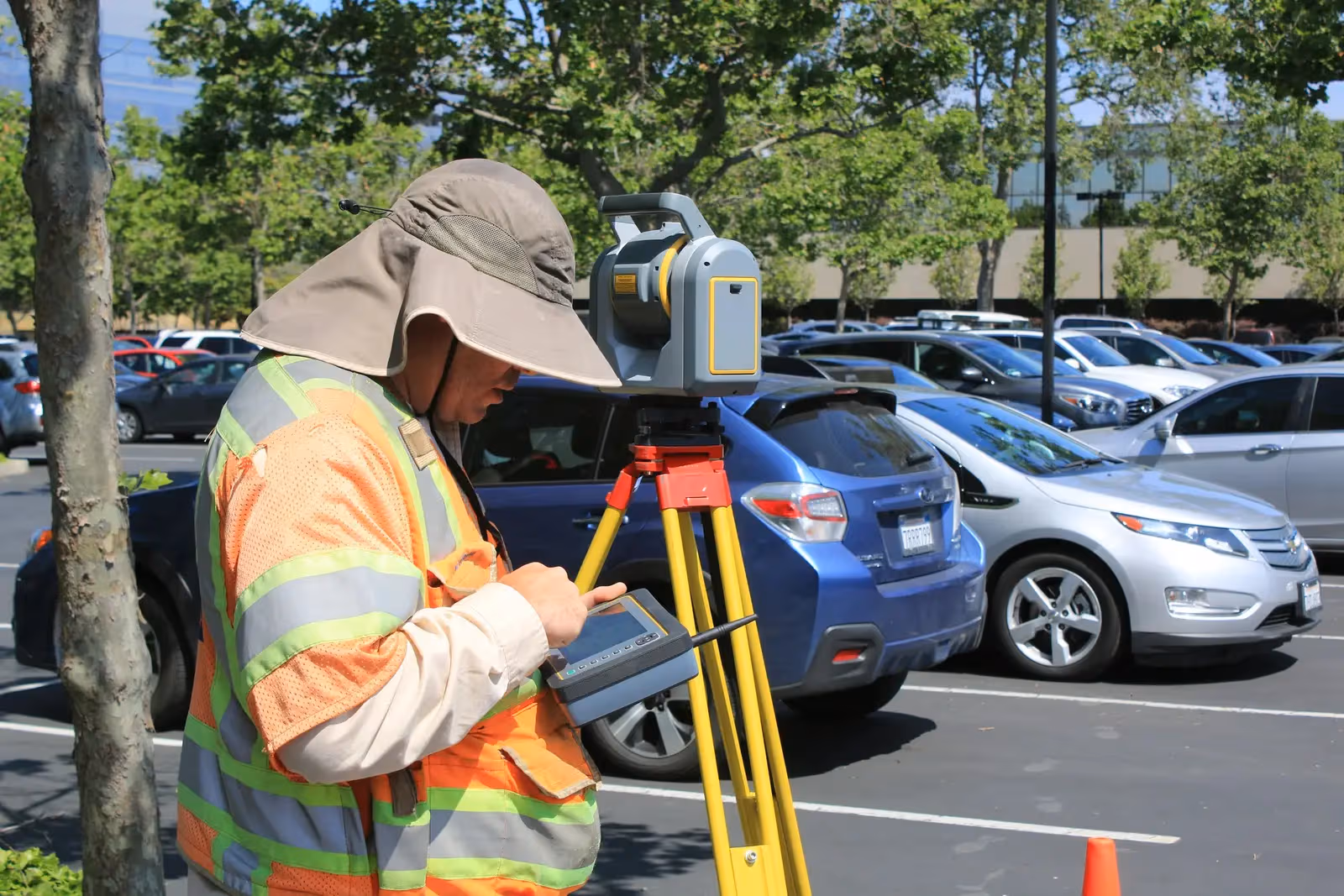
من أسطولنا المملوك (أكثر من 90 جهازاً) ننشر الأجهزة التالية في هذه الخدمة:

أجهزة مساحة لقياس دقيق للزوايا والمسافات: شبكات الإحداثيات والتوقيع المساحي والمخططات التنفيذية.

أجهزة مساحة لتحديد المواقع بدقة سنتيمترية عبر الأقمار (GPS/RTK) لأعمال الإحداثيات والطبوغرافيا والمساحة العقارية.

أجهزة ميزانية أوتوماتيكية ورقمية لشبكات المناسيب والنقاط المرجعية بدقة عالية.
نملك ونشغّل أسطولنا الميداني — لقطات مواقعنا تحمل وسم «من ميداننا» وبجانبها صور تعريفية للفئات.
نعم، نُعدّ التقارير والقرارات المساحية وفق المعايير المطلوبة للرفع على منصّة بلدي ومتطلبات الأمانات.
نعم، نرصد الحدود الفعلية ونطابقها مع الصك ونوثّق الفروقات في تقرير معتمد لتصحيح الوضع.
صور حقيقية من مشاريع GeoGiza الميدانية عبر مصر والمنطقة.
نتحمّل المخاطرة عنك في مشروعك — لتقرّر بثقة كاملة.
إذا لم يحقّق التسليم دقة المواصفات المتفق عليها، نعيد الرفع ونصحّحه دون أي تكلفة إضافية.
نتفق على جدول التسليم مسبقاً ونبقيك على اطّلاع في كل مرحلة حتى الالتزام به.
كل تعاون مغطّى باتفاقية سرية. بياناتك ورسوماتك لا تُشارك أبداً.
تستلم ملفات المصدر القابلة للتعديل (DWG وDXF وغيرها) — ملكية كاملة بلا قيود.