Loading…
رفع طبوغرافي دقيق لمواقع المشاريع
تبدأ مشاريع كثيرة بمخططات قديمة أو إحداثيات تقريبية، فتظهر فروقات في الحفر والردم والكميات تكلّف وقتاً ومالاً على أرض الواقع. الرفع الطبوغرافي الدقيق يمنحك صورة حقيقية للموقع قبل أن تصمّم أو تنفّذ.
مكاتب التصميم والاستشاريون، المقاولون، المطوّرون العقاريون، وأصحاب الأراضي الذين يحتاجون بيانات موقع موثوقة قبل التصميم أو التنفيذ أو حساب الكميات.
زيارة الموقع وضبط نقاط التحكم باستخدام GNSS-RTK
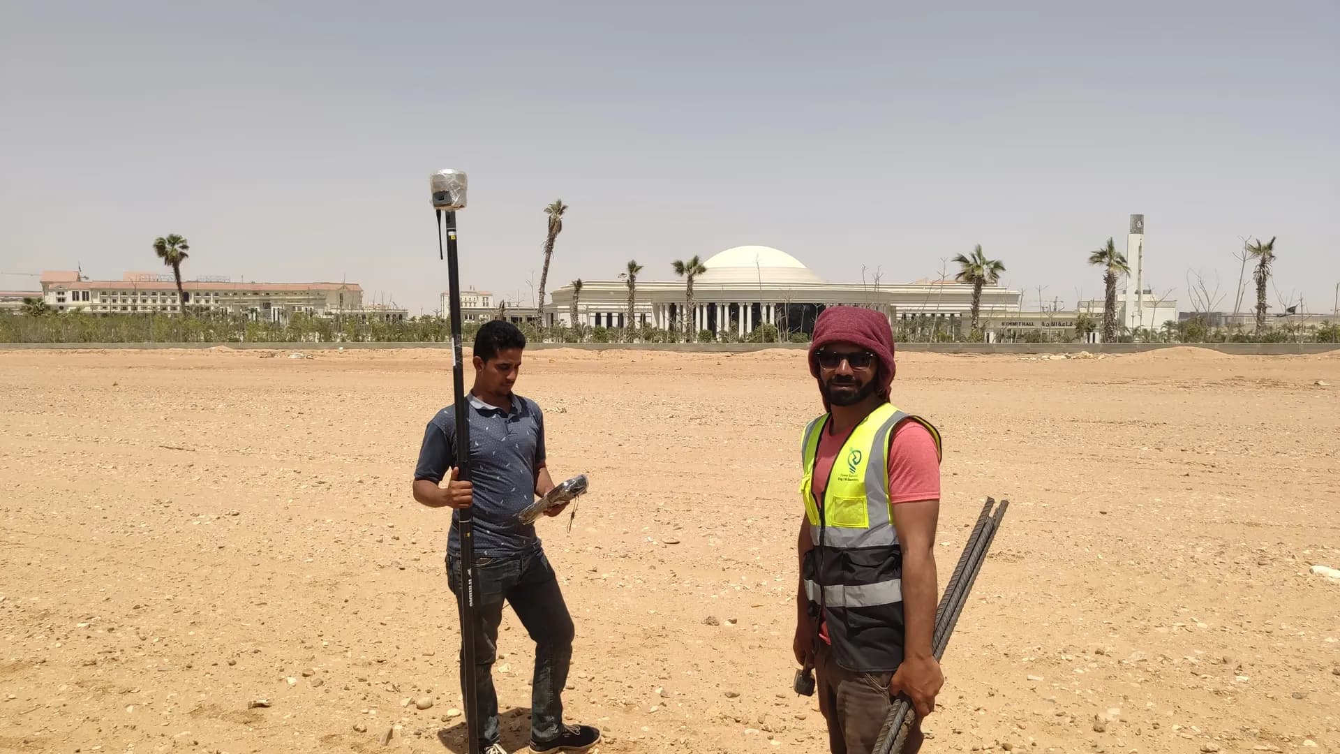
الرفع الميداني بأجهزة المساحة (توتال ستيشن وGPS) والطائرات بدون طيار عند الحاجة
معالجة البيانات وحساب الإحداثيات والمناسيب
رسم الخطوط الكنتورية وإنتاج ملفات DWG/DXF
مراجعة الجودة واعتماد التقرير من مهندس مرخّص
من أسطولنا المملوك (أكثر من 90 جهازاً) ننشر الأجهزة التالية في هذه الخدمة:

أجهزة مساحة لقياس دقيق للزوايا والمسافات: شبكات الإحداثيات والتوقيع المساحي والمخططات التنفيذية.

أجهزة مساحة لتحديد المواقع بدقة سنتيمترية عبر الأقمار (GPS/RTK) لأعمال الإحداثيات والطبوغرافيا والمساحة العقارية.

أجهزة ميزانية أوتوماتيكية ورقمية لشبكات المناسيب والنقاط المرجعية بدقة عالية.
نملك ونشغّل أسطولنا الميداني — لقطات مواقعنا تحمل وسم «من ميداننا» وبجانبها صور تعريفية للفئات.
نعمل بدقة سنتيمترية (±2 سم أفقياً وعمودياً) باستخدام GPS-RTK والمحطات الشاملة.
نعم، نتعامل من 100 م² وحتى مئات الأفدنة، ولدينا فرق ميدانية متعددة وكوادر طائرات Drone للمشاريع الكبيرة.
لوحة الملكية خدمة منفصلة. الرفع الطبوغرافي يركّز على الإحداثيات والمناسيب، أما لوحة الملكية تتعلق بحدود ووثائق الملكية.
صور حقيقية من مشاريع GeoGiza الميدانية عبر مصر والمنطقة.
نتحمّل المخاطرة عنك في مشروعك — لتقرّر بثقة كاملة.
إذا لم يحقّق التسليم دقة المواصفات المتفق عليها، نعيد الرفع ونصحّحه دون أي تكلفة إضافية.
نتفق على جدول التسليم مسبقاً ونبقيك على اطّلاع في كل مرحلة حتى الالتزام به.
كل تعاون مغطّى باتفاقية سرية. بياناتك ورسوماتك لا تُشارك أبداً.
تستلم ملفات المصدر القابلة للتعديل (DWG وDXF وغيرها) — ملكية كاملة بلا قيود.