

When to use this guide
A coordinate alone does not explain how a control mark was established. Build a traceable chain from control provenance, antenna and observations to processing and independent checks, so reference-frame or height changes can be identified during file exchange.
A FIX status or GNSS receiver name does not establish control-network compliance. The coordinate converter changes coordinate representation; it neither processes raw observations nor approves a GNSS network or produces a residual report.
The checklists and examples are original GeoGiza guidance, not specification text, a translation or a compliance certificate. Consult the original document and project scope for applicable grades and mandatory limits.
Edition verified; currentness unconfirmed
Publisher, edition covers and page locators were checked on 11 October 2026. Whether a later official edition supersedes these documents is unconfirmed; check with the responsible authority and the project contract before adopting requirements.
What to prepare before review
- Tie-mark identities, coordinate provenance, reference frame and reference epoch where needed.
- Antenna model, identifier, height-measurement method and units for each session.
- Original observation files, session times, receiver and field logs.
- Processing settings, quality reports and independent check points.
Practical review steps
- 1
Separate mark identity from coordinate values
Attach a mark description, field photograph and coordinate source. Record damaged or replaced marks rather than reusing an old identity for a different physical mark.
- 2
Review antenna and time records
Reconcile antenna heights between field and processing records, including units and measurement point. Keep session names and time conventions traceable to the raw files.
- 3
Obtain processing and check evidence
Review ties and processing settings with the responsible specialist, keeping check points independent of adjustment inputs. Record missing reports before transferring coordinates to construction drawings.
- 4
Test file exchange against a known sample
Use the point template to test column order and coordinate systems against a known sample. Compare it with the original reference before batch conversion, keeping height values and definitions separate from horizontal conversion.
Understand the concept visually
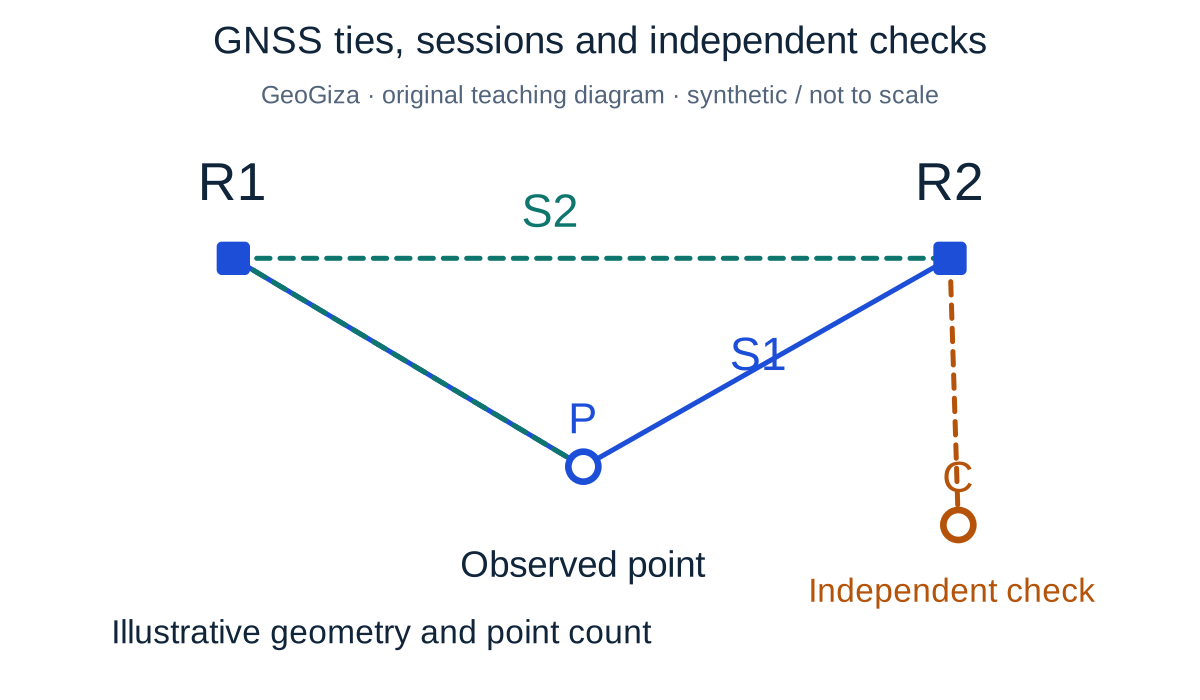
Original GeoGiza teaching diagram · synthetic data · not acceptance limits or official approval
GNSS ties, sessions and independent checks
R1 and R2 are synthetic reference points, P an observed point and C an independent check outside the adjustment. Two colors distinguish sessions S1 and S2; lines show observation/processing ties, not intervisibility requirements.
R1 / R2 = reference; P = observed; C = independent check; S1 / S2 = sessions
FIX alone does not establish coordinate quality; reference ties, observations, processing and checks must be traceable.
Point count and network geometry are illustrative, not a national minimum, session-duration rule or real CORS coverage. Record antenna type, height and measurement reference point.
Consult this topic’s document locatorsSYNTHETIC teaching example — not field observations or a tolerance limit
Synthetic example: undocumented antenna height
A point is logged with FIX status, but its field antenna-height entry is empty. The CSV has a height column without a height-type definition.
What to record in the review
Request the session record, antenna height, height definition and processing report. An EPSG conversion cannot replace this evidence, and FIX is not acceptance of the height.
Mistakes affecting the review decision
- Confusing slant and vertical antenna height or changing units.
- Treating a GNSS ellipsoidal height as a vertical-datum elevation without documented processing.
- Using an adjustment input point as an allegedly independent check.
Official sources and reading locators
Printed page numbers differ from PDF viewer pages. Open the official link and read the complete provision in the edition applicable to your project.
Egyptian Survey Authority · Technical reference
ESA technical specifications — Part I: surveying
First edition — 2020
- Locator:
- Chapter 2: section 1 and subsections
- Printed pages:
- 14–23
- PDF viewer pages:
- 35–44
Source checked:
Frequently asked questions
Does converting between EPSG systems process a GNSS network?
No. Coordinate conversion is distinct from observation processing and network adjustment. Use the tool to check coordinate representation after identifying the reference, and keep GNSS processing evidence separately.
Where do the GNSS source locators start?
In Part I, chapter 2 section 1 and its subsections, printed pages 14–23. Processing-report material lies within that range; the official link below opens its beginning.