Loading…
High-resolution geometrically corrected aerial imagery for project sites
Surveying large or rough sites the traditional way is slow, costly, and sometimes unsafe. UAVs give you a geometrically corrected aerial image covering hundreds of acres in days — accurate enough for design and quantity take-off.
Contractors, developers, energy and mining firms, and anyone needing fast, accurate aerial coverage of large sites.
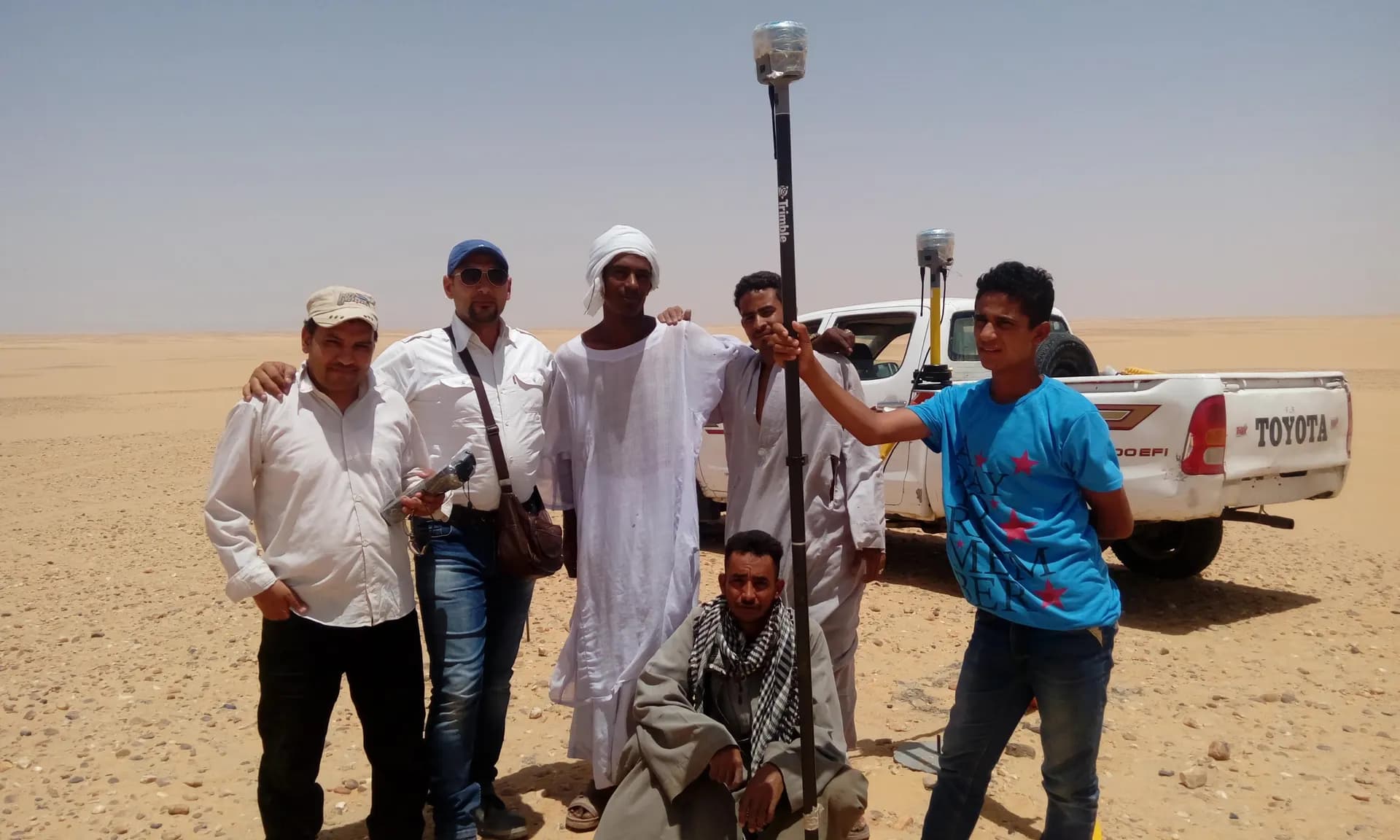
Plan the flight path and distribute ground control points
Fly the mission and capture high-overlap imagery
Photogrammetric processing and model reconstruction
Produce the orthomosaic + DSM/DTM and run QA
From our owned 90+ instrument fleet, we deploy the following on this service:

UAV photogrammetry and LiDAR for orthomosaics, topographic mapping, and asset inspection.
We own and operate our field fleet — our site shots carry the “From our field work” chip, alongside class-reference photos.
Ground resolution reaches 2–5 cm per pixel depending on flight altitude, with centimeter positional accuracy when GNSS-RTK ground control points are used.
We advise on the requirements and coordinate the necessary permits before the mission, based on the project location.
Real photographs from GeoGiza's field projects across Egypt and the region.
We take the risk off your project — so you can commit with confidence.
If a deliverable misses the agreed accuracy spec, we re-survey and correct it at no extra cost.
We agree the delivery schedule up front and keep you updated at every stage until it's met.
Every engagement is covered by an NDA. Your data and drawings are never shared.
You receive the editable source files (DWG, DXF and more) — full ownership, no lock-in.