Loading…
We recover and mark the Egyptian Survey Authority’s cadastral markers and benchmark points on the ground for your agricultural land or village parcel, tying your boundaries to the official survey network with documented accuracy that prevents overlap or future disputes.
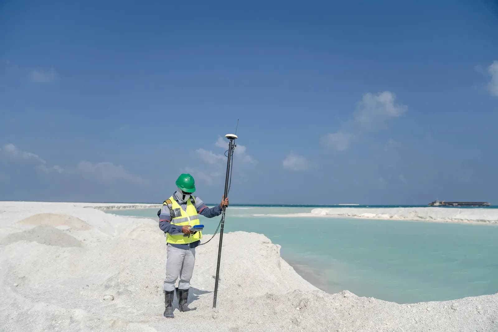
Many village landowners don’t know the official boundary of their land precisely, so encroachments, overlaps, and disputes with neighbours arise. We pinpoint the approved survey markers and benchmark points on the ground and tie them to the Survey Authority’s network, so you know your boundary to the centimetre.
Villagers and owners of agricultural land who need to establish their boundaries against the official survey points before building, selling, or settling a dispute.
Review documents and identify the basin and parcel number in the survey records
Field survey and search for the markers and benchmark points with GNSS and total stations
Tie the boundaries to the Survey Authority’s official reference network
Mark the points on the ground and hand over a signed memo and sketch
From our owned 90+ instrument fleet, we deploy the following on this service:

Survey instruments for precise angle and distance measurement — control networks, layout, and as-builts.

Survey-grade GPS receivers for centimeter-accurate satellite positioning (RTK) — control, topographic, and cadastral work.
We own and operate our field fleet — our site shots carry the “From our field work” chip, alongside class-reference photos.
Yes — we tie your boundaries to the reference network approved by the Egyptian Survey Authority using calibrated GNSS equipment, and we document the coordinates in a technical memo.
Yes — we re-establish the boundary from the survey records, basin, and parcel number, then mark it on the ground with clear new points.
Real photographs from GeoGiza's field projects across Egypt and the region.
We take the risk off your project — so you can commit with confidence.
If a deliverable misses the agreed accuracy spec, we re-survey and correct it at no extra cost.
We agree the delivery schedule up front and keep you updated at every stage until it's met.
Every engagement is covered by an NDA. Your data and drawings are never shared.
You receive the editable source files (DWG, DXF and more) — full ownership, no lock-in.