Loading…
Depth measurement of water bodies at navigation-grade accuracy
Designing ports, bridges, and water structures without an accurate picture of the bed puts the project at risk. A bathymetric survey gives you a precise depth map for safe decisions.
Port authorities, marine-works consultants, bridge and water-structure contractors, and dredging companies.
Rig the boat and sonar and tie it to GNSS positioning
Run depth survey lines at appropriate density
Apply tide/current corrections and process the data
Produce the depth map and run QA
From our owned 90+ instrument fleet, we deploy the following on this service:

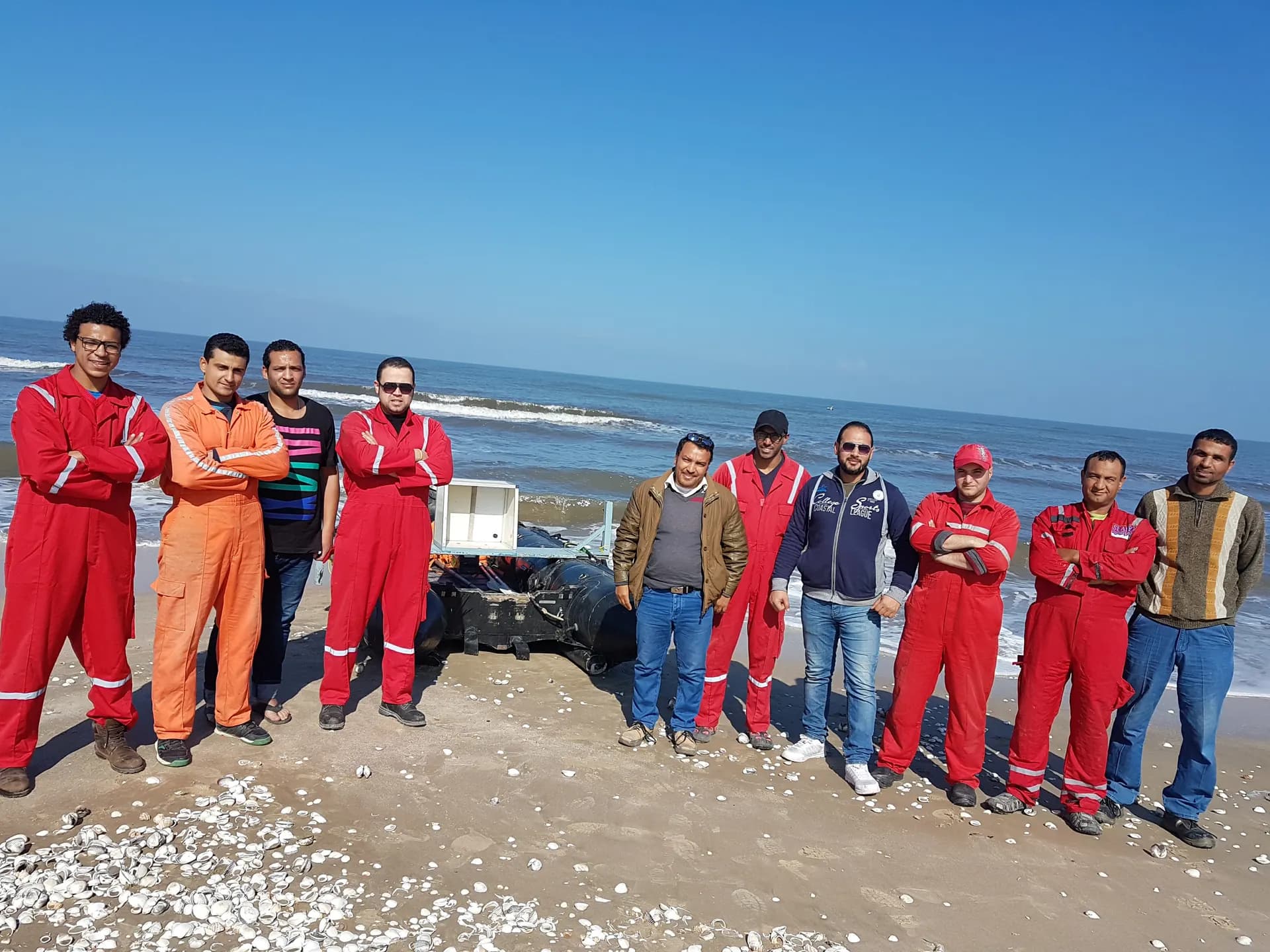
Single-beam echo sounders and survey vessels for bathymetric and hydrographic surveys.
We own and operate our field fleet — our site shots carry the “From our field work” chip, alongside class-reference photos.
Single-beam is economical for regular areas; multibeam gives full-bottom coverage for critical zones and ports — we pick what fits your project.
Yes, we apply tide and current corrections to tie depths to the reference datum accurately.
Real photographs from GeoGiza's field projects across Egypt and the region.
We take the risk off your project — so you can commit with confidence.
If a deliverable misses the agreed accuracy spec, we re-survey and correct it at no extra cost.
We agree the delivery schedule up front and keep you updated at every stage until it's met.
Every engagement is covered by an NDA. Your data and drawings are never shared.
You receive the editable source files (DWG, DXF and more) — full ownership, no lock-in.