Loading…
Custom GIS dashboards for ops & exec teams — live maps, spatio-temporal filters, automated alerts. Mapbox/MapLibre + PostGIS + React. We host, monitor, and maintain.
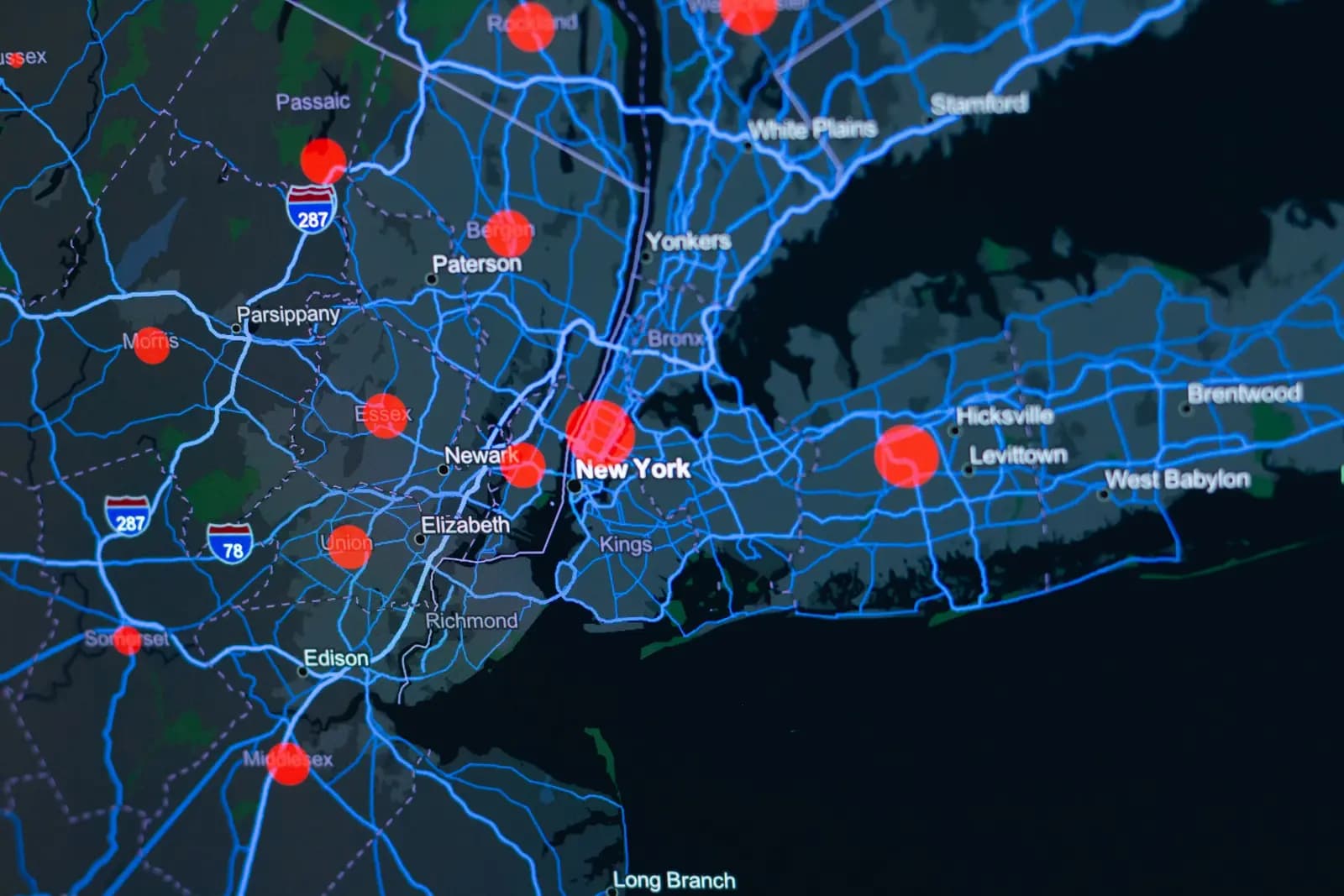
Your spatial data is trapped in PostGIS or slow PDF reports — nobody sees the live picture. We build an interactive GIS dashboard that shows site and project on one map, in real time.
Ops and exec teams, project owners, and organizations holding spatial data who need to visualize and decide on it.
Discovery workshop — define users and permissions
Design the map experience and panels
Build with Mapbox/MapLibre, PostGIS, and React
Deploy, host, monitor, and train
Yes. All code written for a client is delivered to them in full in Git, with unrestricted right to use and modify.
Either. Default: we host on AWS/Azure and monitor with Sentry. On-prem option: we deliver a ready Docker Compose bundle.
Real photographs from GeoGiza's field projects across Egypt and the region.
We take the risk off your project — so you can commit with confidence.
If a deliverable misses the agreed accuracy spec, we re-survey and correct it at no extra cost.
We agree the delivery schedule up front and keep you updated at every stage until it's met.
Every engagement is covered by an NDA. Your data and drawings are never shared.
You receive the editable source files (DWG, DXF and more) — full ownership, no lock-in.