

The method is a risk decision before it is a technical one
When a client asks us to "survey the bottom", the first question we ask back is not which sonar — it is what has to be true about the result. Do you need a depth map, or do you need proof that nothing was missed between our lines? Are we monitoring a slowly silting reservoir, or computing a dredging volume that someone is going to be paid against? Those answers decide whether a single-beam echo sounder is honest enough for the job, or whether only a multibeam swath will do.
On our water jobs we run both classes of sounder, and we have learned the hard way that the cheaper instrument is not the cheaper project if it forces a re-survey. This article is how we actually choose between them, framed around the standard every serious hydrographic deliverable is measured against — IHO S-44.
Single-beam vs multibeam at a glance
| Criterion | Single-beam (SBES) | Multibeam (MBES) |
|---|---|---|
| Bottom coverage | A line of points along track; gaps interpolated | Continuous swath — near-full coverage |
| Feature detection | Misses objects between lines | Detects small isolated features |
| Day rate / mobilisation | Low — small boat, light kit | Higher — sonar head, motion sensor, processing |
| Best for shallow narrow water | Strong — canals, small reservoirs | Possible but often overkill |
| Volume / dredging certainty | Interpolation error between lines | Surface-based, defensible volumes |
| Processing effort | Light | Heavy — clean, filter, grid |
Two valid tools for different problems — not a better-vs-worse contest. Highlight marks the stronger fit per row.
How the two sounders actually see the bottom
A single-beam echo sounder (SBES) fires one narrow pulse straight down and times the echo. You get one depth directly beneath the transducer, repeated as the boat moves. Everything between your survey lines is interpolation — an educated guess. Run lines close enough and the guess is fine for a smooth canal bed; run them sparse over a rocky bottom and you can sail straight over an obstruction without ever knowing it was there.
A multibeam echo sounder (MBES) fans out dozens to hundreds of beams across-track, painting a continuous swath of the bottom in one pass. Overlap the swaths line-to-line and you get true full-bottom coverage — the basis for feature detection and for volumes you can stand behind. The price you pay is complexity: a multibeam needs a motion-reference unit, an accurate sound-velocity profile, precise GNSS heading, and a disciplined patch test to resolve the angular offsets between the sonar, the motion sensor, and the positioning. Skip any of those and the swath edges curl into artefacts.
Let IHO S-44 drive the method
Per IHO S-44, every hydrographic survey targets an accuracy order with explicit limits on total horizontal and vertical uncertainty, plus a feature-detection and bottom-coverage requirement. The stricter orders (Special / Exclusive) effectively require full-coverage multibeam, because a line-spaced single-beam survey cannot prove that a small feature between lines was not missed. We confirm the required order — from the client, the port, or the maritime authority — before we mobilise, then design a sounder and line plan that can demonstrably meet it.
IHO S-44 orders and the method that typically fits
| S-44 order (typical use) | Coverage expectation | Practical method fit |
|---|---|---|
| Exclusive / Special (harbours, critical underkeel) | Full bottom coverage + small-feature detection | Multibeam (full-coverage) |
| Order 1a (areas where features are a concern) | Full coverage / high feature search | Multibeam, sometimes SBES + side-scan |
| Order 1b (features not expected to be a hazard) | Coverage by line spacing; no full search | Single-beam often sufficient |
| Order 2 (deep / low-risk water) | Lower coverage density | Single-beam, wider line spacing |
Indicative mapping only — read the current S-44 edition for the exact uncertainty limits and coverage wording. · Order definitions and coverage concepts per IHO S-44. Use the governing edition for binding limits.
Bottom coverage by method (illustrative)
Calibration is part of the method, not an extra
Whichever sounder you run, the result lives or dies on sound-velocity profiling, tide / water-level reduction to a known datum, and — for multibeam — a clean patch test for roll, pitch, yaw, and timing latency. A well-calibrated single-beam beats a sloppy multibeam every time. We schedule calibration as a named line item, not a box to tick at the end.
How we run a bathymetric survey
- 1
Confirm the deliverable and the required IHO S-44 order, then pick single-beam or multibeam to match.
- 2
Plan survey lines (or swath overlap), tide stations, and the vertical datum the depths reduce to.
- 3
Mobilise: mount the transducer, motion sensor, and GNSS; check offsets and lever arms.
- 4
Calibrate: take a sound-velocity profile and run a patch test for multibeam before logging data.
- 5
Acquire on plan, watching real-time coverage and helmsman line-keeping against the line plan.
- 6
Reduce and clean: apply tide/SVP corrections, filter outliers, and grid to a surface.
- 7
QC against the order's uncertainty limits, then deliver the depth model, contours, and volumes.
The sonar class we field for depth work
 From our field work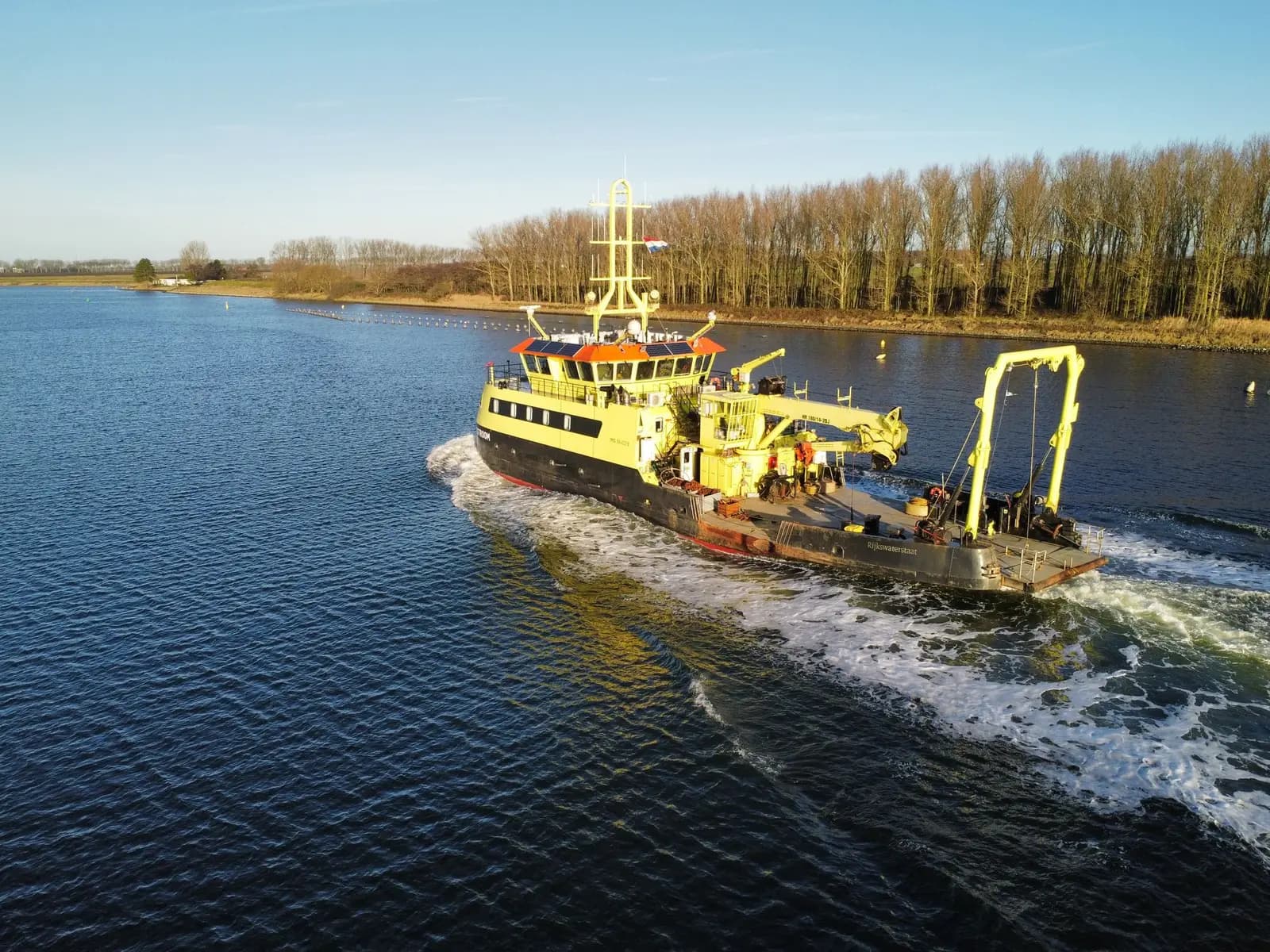
Sonar & hydrographic
Single-beam echo sounders and survey vessels for bathymetric and hydrographic surveys.
single-beam echo sounders
Single-beam echo sounders from our 90-instrument fleet, paired with GNSS positioning and motion sensing on the survey boat.
Take it further
References
- IHO S-44 — Standards for Hydrographic Surveys — International Hydrographic Organization (IHO)
- International Federation of Surveyors publications on professional and cadastral standards — International Federation of Surveyors (FIG)